The Boulders of Smakw'uts
Coast Salish monumental boulders
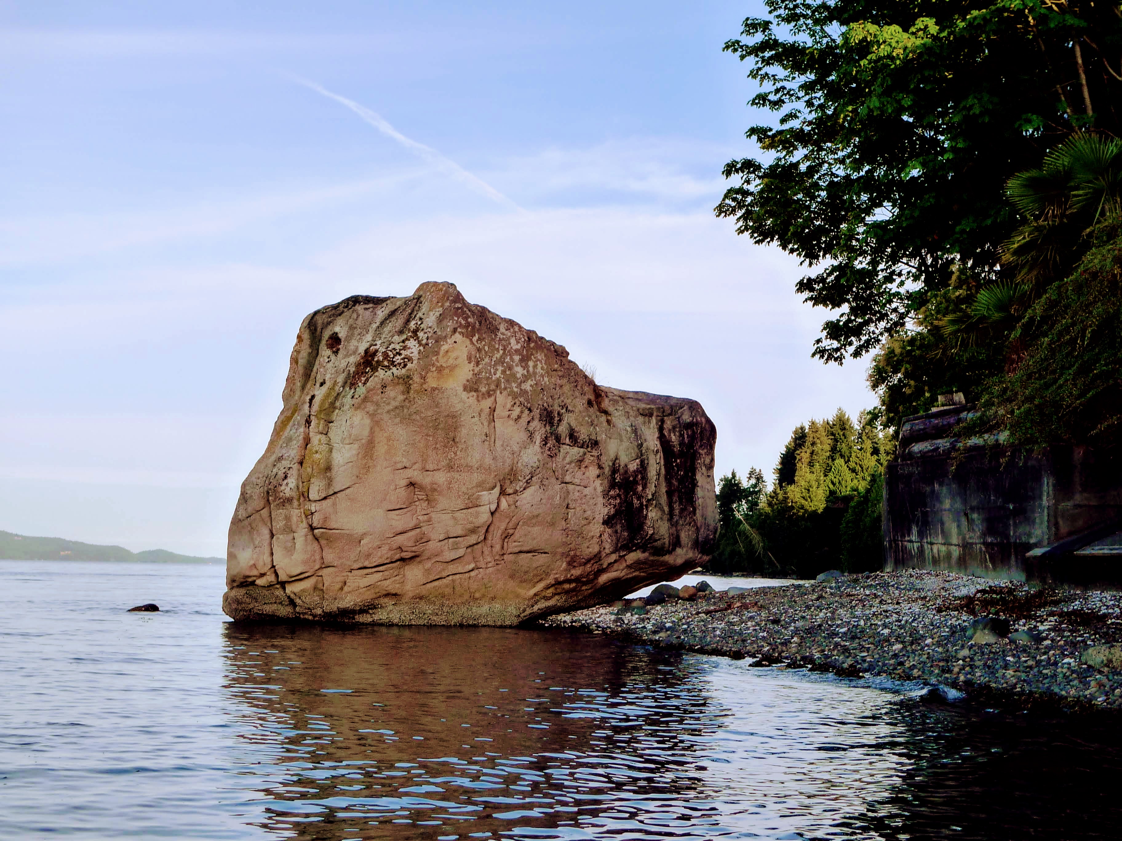
Monumental boulders -- the glacial erratics and other feature boulders found throughout the Salish Sea -- are prevalent in the oral histories of Coast Salish peoples. These are not merely inanimate rocks, but important actors in the stories, marking ancient, ancestral connections between people and landmark places.
By being attentive to oral histories about monumental boulders, we hope to emphasize the networks of relationships that Coast Salish peoples have throughout their territories.


Smakw’uts and the Transformer
Stories of the giant Smakw’uts, who threw boulders from Point Roberts across the Salish Sea, and of the Transformer(s) who travelled through Coast Salish territories changing people and animals into rocks, are well-known oral histories which animate a lived cultural landscape.
The stories of Smakw’uts and the Transformer Xeel’s reflect, among other things, the connections and relationships between key locations on the mainland, and places in the Gulf Islands and along the southeast side of Vancouver Island.
These stories embody the intimate knowledge of landmark places across the region, and describe how people and other beings travel, relate, and connect powerfully to, across the Coast Salish cultural landscape. People know these places as landmarks. The relationships embodied in the stories call to be mapped.
Mapping Smakw’uts
We have set out to map the connections and relationshipos between places marked by the actions related to monumental boulders in Coast Salish oral histories, unconstrained by present day political or tribal boundaries.
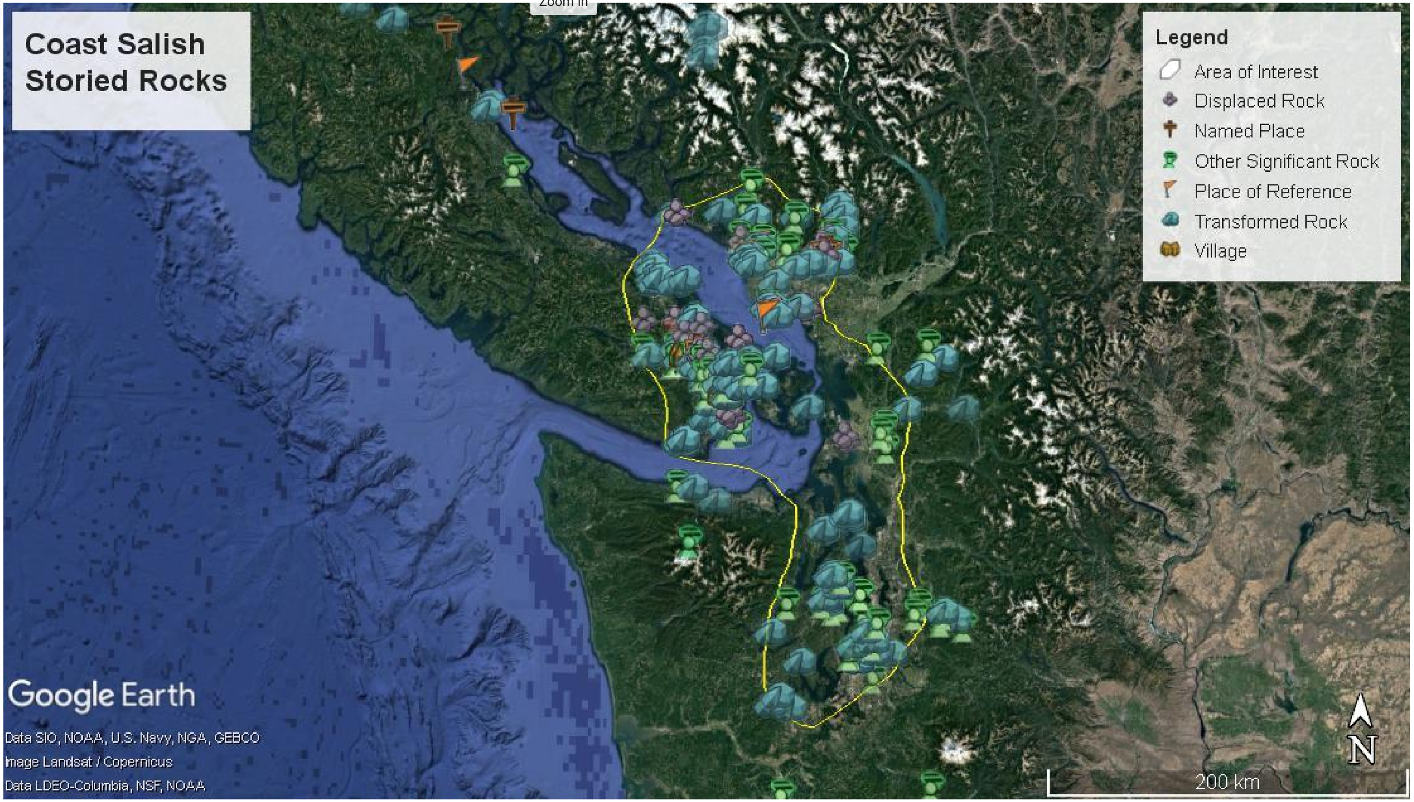
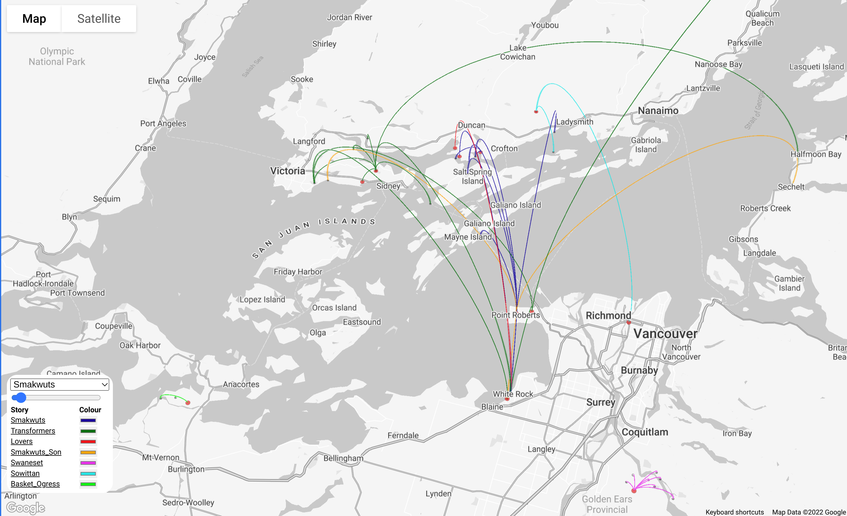
Our research project began with a literature review of Coast Salish ethnography. Over 500 sources were surveyed, and 91 were compiled which directly speak about monumental boulders. These stories were then referenced to map monumental boulders using Google Earth and deck.gl. Over 200 rocks within the Central Coast Salish area and Puget Sound were mapped in Google Earth Pro. For our webmap, we have taken a subset of these from stories where rocks were flung across the landscape, to create a map using arcs to indicate the points of origin and destination of the rocks.
Our project draws on the powerful deck.gl scripting language to dynamically represent territorial relations in a web map empowered by Google Maps. More technical information on how we did this, and our Creative Commons Licence script can be found on GitHub.
To access the Smakw'uts map, select it from the drop-down menu at the top of the legend in the lower left corner of the map.
