Problematic Polygons
the 'paradox of boundaries'
For generations, anthropologists (and others) have made representations of Indigenous peoples territoires drawing on conventional cartographic 'polygons' to depict neat, continuous, bounded territorial boundaries.
Research has suggested that the 'polygon' may be being asked to do too much work connecting principles of Indigenous land tenure with relational ontologies of territory. This is not to say that there are no territories, no property, no land rights, or that there are no boundaries. However, drawing on the cartographic convention that visualizes indigenous peoples land tenure exactly the same way European nation states are depicted risks an ethnocentric hubris, and avoids one of the central principles of many Indigenous peoples' territoriality: relationships.


relational cartography
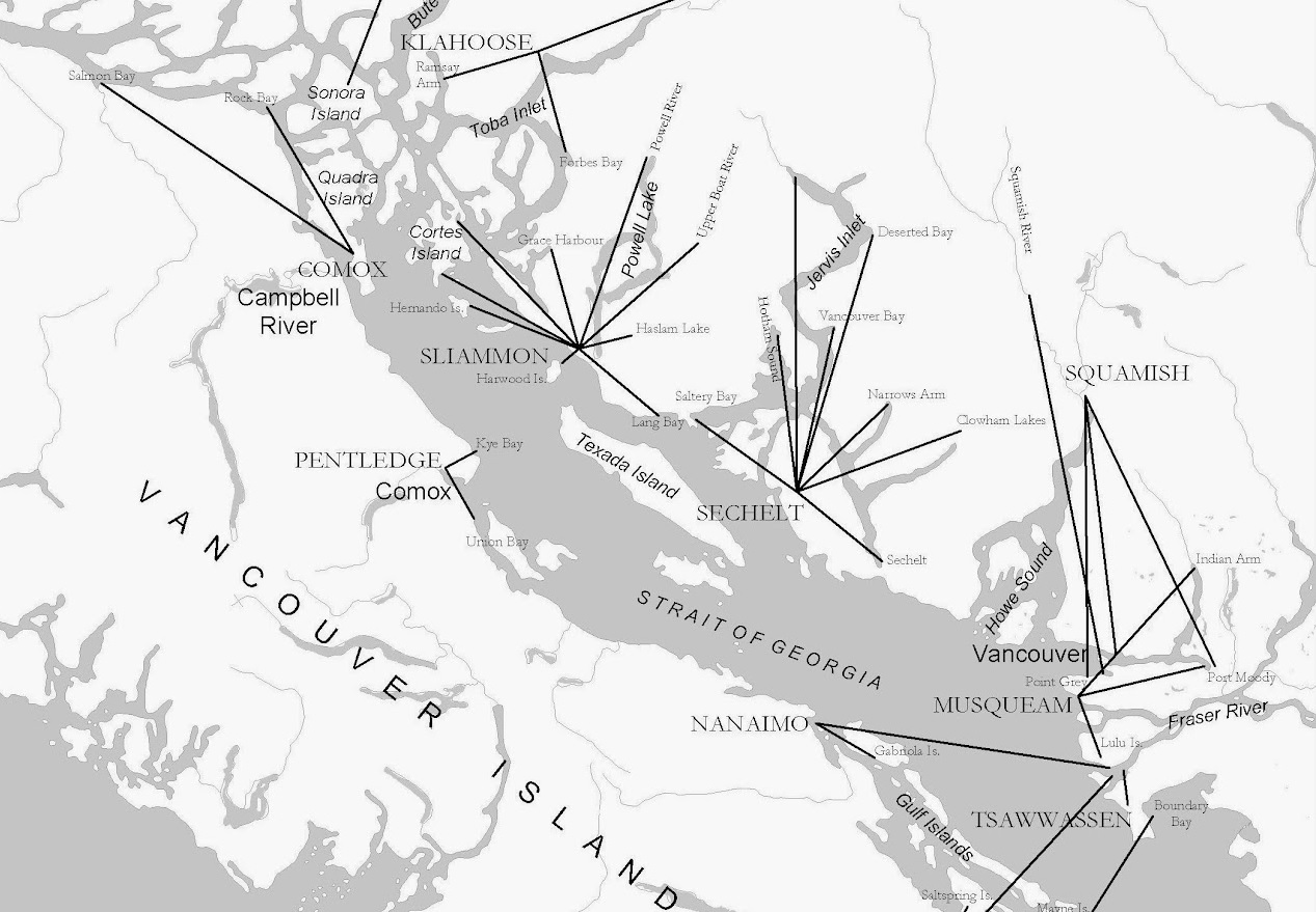
Some (few) representations of Indigenous territorial relations have eschewed the polygon in favour of other modes of representing Indigenous connections to place.
In the 1950s, anthropologist Homer Barnett suggested an approach to mapping Coast Salish territories by showing connections between home village sites and the locales of various “hunting, gathering and wintering activities” (Barnett 1955, 18). We have redrawn his sample map here to illustrate his vision.
H. Barnett, The Coast Salish of British Columbia (Eugene, University of Oregon Press, 1955).
a cartographic experiment
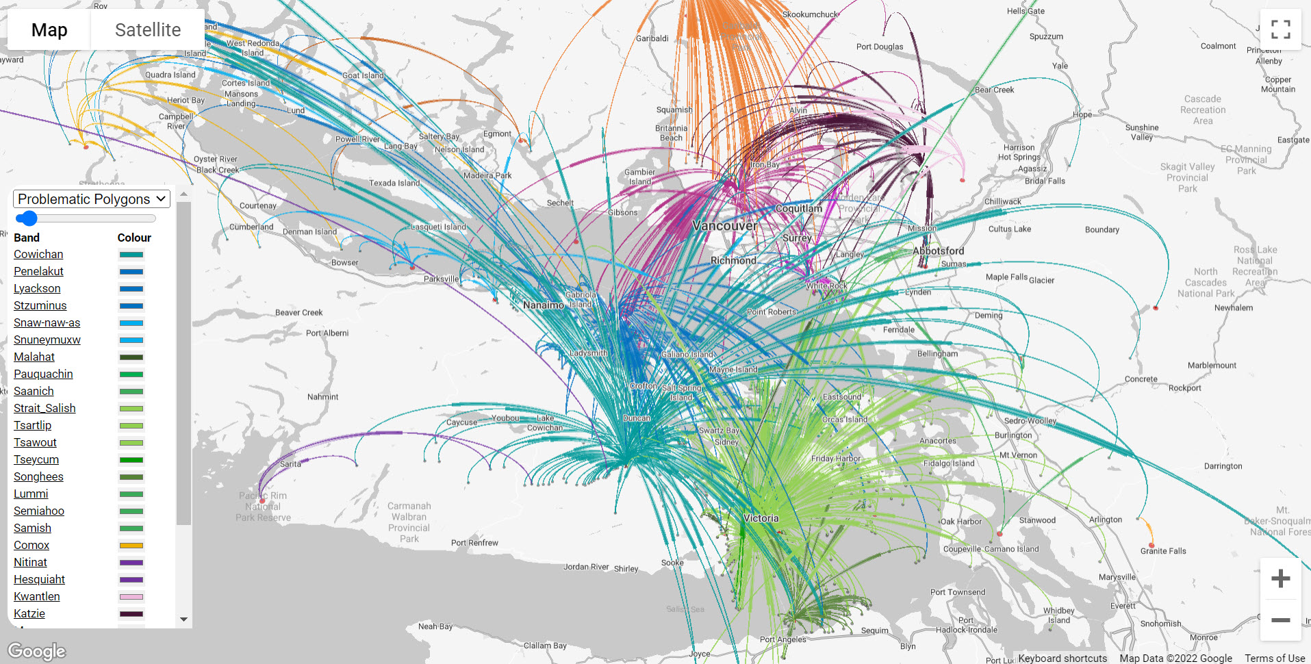
Our work is an experiment in cartographic alternatives to the polygon for representing Indigenous territorial relations.
Following anthropologist Brian Thom’s (2009) suggestion to develop a radical cartography for illustrating Indigenous territoriality, we have expanded on Barnett’s original map to visualize arcs that radiate out from home communities to places cared for and about by Indigenous peoples. This provokes different senses of territory. It works to decenter the "boundary" and rather draw attention to the connections and relationships people have to the important places in their lives.
Our project draws on the powerful deck.gl scripting language to dynamically represent territorial relations in a web map empowered by Google Maps. More technical information on how we did this, and our Creative Commons Licence script can be found on GitHub. You can read more about our project in English, Français, Español.
B. Thom, The Paradox of Boundaries in Coast Salish Territories. Cultural Geographies 16(2):179‐205. http://hdl.handle.net/1828/6281
